Monday 16 November 2015

Exceptional Everglades


Two groups milled around the national parks station early that Thursday morning. The one much larger, dapper dressed folk were being politely dealt with by the NP ranger sorting them out for their day out on a motor boat excursion in the everglades. The other party loitering was a single Muppet. Not so dapper, with paddle in hand and Life jacket round shoulders. When the ranger finished off with the fore mentioned day trippers and turned to said paddler his demeanor changed from polite to joy. His enthusiasm in helping the lone paddler organise his itinerary, routing, overnight stays in the 10 000 islands Nat Park. It was clear where his passion lay. It certainly lit up my enthusiasm. No talk of the perils of the 'glades, gators and the like. 


Paddling the everglades was an exceptional adventure, exceeding my expectations by a country mile. Crossing the expanses of the Gulf, island hopping from key (Island) to key and then wandering through wide open water expanses or exceedingly narrow passages of the inland mangroves. It was magic. And I only touched a fraction of what it really had to offer. This being my first multiday kayaking trip in 30 years, it rekindled old memories of our canoeing trips down the Zambezi River during the mid '80s. There were plenty of parallels.

My 3 1/2 day sojourn made possible by a company conference in Miami and the timing was perfect for such a trip. Much earlier and it would have been scorching hot and wet, with the potential of Typhoons. Any later would have hit the high season and locations limited, maybe but certainly not the solitude I enjoyed. As it was, I never saw another canoe and only 4 motor boats passed me 
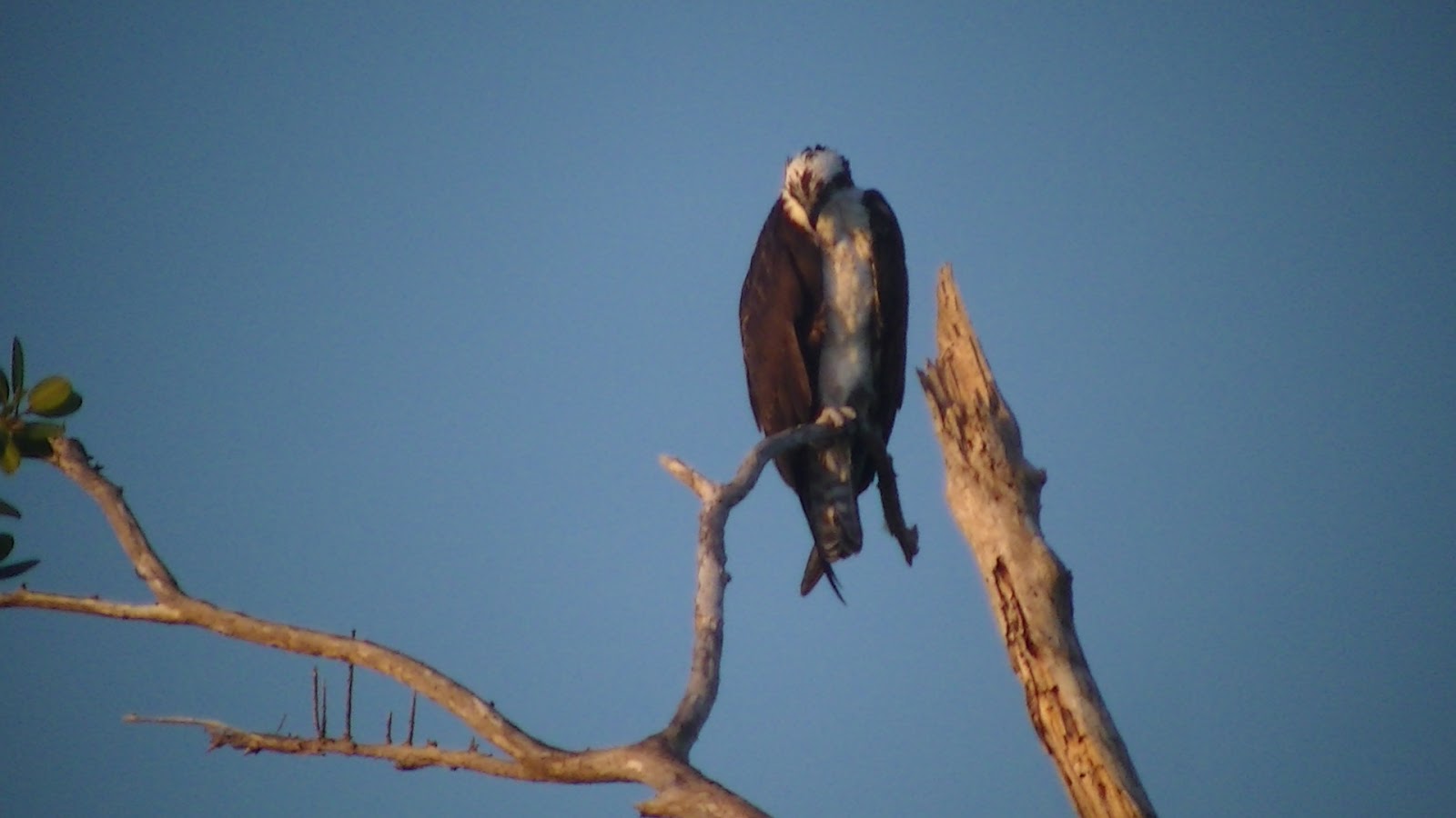
in that time. So the company I had was abundant dolphins, see why they're called the NFL Miami Dolphins, masses of bird life, especially out on the keys, a couple of manatees, and a few Gators to cap it all off. Fortunately having left my newly acquired fishing rod behind, unintentionally, the whopper I'd bragged about remained safe and the fresh pan fried fillet a mere dream, next time.

As soon as the Miami conference was confirmed the search was on for an accompanying adventure. It would be tough to top the Utah canyoning of last year. There really wasn't any hiking of significance in these parts, and I'd just done the Sierras not a month earlier. 

Looked into a bike touring gig that looked promising and then by chance came across a region of Florida called the 10000 islands. Like opening Pandora box there all of a sudden a wealth of information on kayaking around this region. Kayaking a great option; you can take more kit than a hike, as you don't have to carry it. On this trip did have to take all your water. The trick to an uneventful trip is good navigation and reading and using the tides. Having done neither on water that made all the more interesting for the new challenge. 

Had a basic idea; do a loop, couple days in the mangroves then head out to the open water when I was more comfortable and confident with the boat, the conditions, navigation and whatever else needed to be done. With the ranger at the national parks office we mapped out a trip that made better use of the tides. So it was out to the islands first; Pavilion key one of the farthest and largest. Then back into the Mangroves, farthest inland; Sweet Water Chickee. Then winding back to the start staying at Crooked Creek Chickee. (For those not in the know Chickee refers to the platforms constructed in the mangroves to park out on. 

By 9:30 boat hired, permit secured, four gallons of water loaded up, nosh in secure container (keep raccoon's out), and aye captain launch the boat. With a bit of cloud cover and gentle ripple on the water, conditions were perfect. Particularly welcome for relatively novice paddler. And with the outgoing tide made good progress winding my way out to the Gulf. This was too easy. Pulled into the side, on a mangrove Island, for a short break after an hour or two, but was quickly sent packing by the swarm of Mossies, swamp angles, as they're known here. I was getting the hang of this open water navigation, kept the nautical map between my legs and GPS round neck and started to get a feel of relating the 'landscape' to the map. Eventually hitting more open water after a couple of hour winding my way through the water ways. Not too surprisingly the wind picked up, it was a bit bouncy, not enough to get too concerned though. 

Hit the outer Keys by lunch and my first night stop, Pavilion Key by 4 ish. This was idyllic. Pristine lagoon on the one side, open sea the other separated by narrow beach of maybe 10 meters wide, where I pitch my tent in the middle. The seaside beach a mass of birds settling down for the night. As I approached they would take off pretty much together, triggered by the least courageous of the lot. Then circle round and land back couple meters up the beach, out of harm’s way, me. And being 5 year old at heart, this looked like fun so ran up and down the beach them critters circling round as I approached, coming back as I passed. All cussing and complaining about this latest intruder. Eventually we both soon settled down. After all it was sundowner time, so accompanied by a little drop off Argentinian Malbak to watch the most spectacular sunset over the Gulf of Mexico. Could life get any better? So did my best to capture the photo opportunity. With the 20 hour flight from Sydney catch up and a full day paddling was man down by 8. Which was a good thing? As soon as you moved out of the sea breeze the angels attacked with a vengeance. In these parts the wind is your friend.

If the sunset was a show, so was the sun rise over the lagoon side the following morning. And to add to the backdrop of the sunrise, the dolphins were out too for morning breakfast.
Faffed around too much only getting going by 10. However, by that time it was low tide so perfect for a run in back to the inland mangroves. Being low tide though it required a 50 meter wade in the mud to open water. And in the process must have dropped my glasses. Again, I'd done a similar thing in the High Sierras a month ago. 

Finally we were off to Sweet Water Chickee averaging between 3 to 5 km/hr. That was the case until I hit an oncoming tide for a section of the Hutson River. I'd been congratulating myself on my navigation prowess. Then became a little too lax with checking my GPS and all of a sudden found this against current paddling was in fact the taking me wrong way, not entirely, certainly it was the long way round. Dick head that will teach me and now GPS battery power was getting low, just when I really needed it to find my night stop over. You certainly wouldn't want to get into grief in these parts. Open water simply merges into the dense mangrove vegetation. 

Late afternoon the waters were like glass, reflecting the mangrove landscape above water. So of course tried to capture with a few pics.  I was disturbed by what I thought were a pod of dolphin that popped up in front of me. Except these critters grunted on surfacing, definitely no dolphin. Actually Manatees. Strangest of creatures. The Ranger said I might spot them up here.

Found the Chickee and once again it was my own for the night. These platforms, Chickee were located 15 meters in from the edge of the mangrove. They have two interconnected platforms with a shared porta loo in the middle. Just a fantastic idea. I set up shop and had a quick dip in the river to clean. Only then saw couple a gators slinking across the water’s surface 10 meter out. That was noted for future swims or maybe not.

Once again another magic sunset. Very much like the Zambezi canoe trips we used to do. And then the mossies came. And that called for a hasty retreat inside the tent for lock down. Come morning, coffee and breakfast consumed inside. Only making a bolter for the loo.

After two big paddling days this shorter section certainly was welcome relieve. Not as secluded as the last, Crooked Creek was closer to the main water thorough fare. And being closer to the edge of the mangroves, expected a mossie invasion. Fortunately the wind picked in the afternoon and we had a rain storm in the evening as the sunset. Giving us a monkeys wedding. Main sunset in the west while rain sweeping through from the east.


I needed an early start in the morning and take advantage of the early high tide. So was on the water by 6 am, still pitch dark. Used by bike lights to light up the way. And hopefully spot me some gator eyes lurking on the mangrove banks. None materialized. Once again another stunning sun rise though.


This day I made fantastic progress with the tide 6 to 7 km/hr. So was able to take the long way home following the narrow Taylor River back. If there was one element to the trip I hadn’t done, one box not ticked, was burrowing through the narrows of a Mangrove creek. Well that all changed. The Taylor River all but disappeared, and I was off the navigation map, so not too sure of the route. However there was a little gap opening in the thicket. So in I dived. Initially, for two k's I was against the current, leading me to think this was a dead end. It then turned; it was like a turbo booster. And I needed this kicker. At slower speeds the 'Angles' could keep up. I was being attacked from all sides. With the water current, the buggers were left for dead. So for the next several km, I wound through the mangroves, dodging overhangs, cutting way through the spider webs, disturbing the roosting birds, and wondering when I'd come face to face with a Gator minding its own business on the side of the bank. And if it were a big daddy, there would be no room for two of us in this narrow passage, fortunately no 'luck'. All in all it was magic. It opened up eventually and in 20 min was back where it all started 3 1/2 short days ago at the National Parks Rangers Station in Everglades City.


Day one - 20km

Day 2 - 26km

Day Three - 18km

Day four - 16km

Monday 28 September 2015

High Sierras - A pass a day: Horseshoe meadow. Plus bonus Tuolumne Meadows


Trip summary - Horseshoe Meadows Trail Head. 
1 Horseshoe meadow>long lake>new army pass.
Overnight soldiers lake
2 sky blue lakes>Crabtree pass
Overnight lower Crabtree lake
3 PCT guyot pass>syberian pass
Overnight big Whitney meadow
4 Cottonwood pass> horseshoe meadow
Approx distance 80k. 55miles
Elevation gain: ~4000m
Start gear weight 13kg. 3.4 fully loaded bear canister.
The Red line

The narrative:
After the long haul from Sydney and drive up to Lone Pine, and the next day onto horseshoe meadows was this bunny happy to hit the trail. Weigh in was 13 kg. Including bear box and requisite vino for evening sundowner. That wasn't without its dramas. Bought a corked bottle. No cork opener. Back to store. Buy 80cent cork opener. Attempt to open. Break cork opener. Return bottle for screw on top. Decant in you bueat platypus reserve 'bladder', we're back in business.
What an amazing drive up to the trail head. Traversing the side of the East Sierras.


There's always last minute scramble at the TH. And as i later discovered. Left my permit in the car. Nice one.
It's a wonderful feeling stepping onto the trail. Finally. All the prep. Particularly on foreign lands. Maps blogs, Google Earth, caltopo etc.  Can only tell you so much. I'm constantly reminded never confuse the map with the territory. Time check 12 o'clock kick off. And a big thanks to those who gave advice particularly on High Siera Topix. Appreciated. 

Off we surge with much gusto. Mmmm blowing a little harder than usual. Maybe this altitude thing is legit.
Pass my first alpine lake (long lake). Picture postcard stuff. 


Tree line to sky line admiring the awesomeness

Trail well traveled, High lake

And we press on to New Army Pass. High Lake another beauty. Obligatory photo and forge on to NAP. It kicks up, i can certainly feel the lack of air. It's a great trudge up switch backs and all. 14 i think i counted. Only getting to the top around 6. If i went down no way was i coming back to go up mtn Langley. So raced down at a rate.  Needed to get to a tree or two to hang my home. Coming into soldiers lake at 7. Now this looks like a cool spot. I wasn't the only punter who thought so. Certainly enough room for all. Meet friendly Ranger Lauren. Nice chat asks for my permit. I go scratching around for it. She says don't worry. Obviously impatient with me. It was only then that i figured i actually didn't have it. Damn. So what's the punishment for not having a permit i wondered. I did give it some thought. But really i wasn't going back over that pass. If asked again I'd just fess-up and sweet talk the ranger. What a dunce though.

Puffin up the pass

Shadows over New Army Pass


Took a while to find a spot. Actually elevated up the side. Two sturdy trees the right distance for Hammock hanging.
Dehydrated black bean chilli pot consumed at a rate. Should have let it hydrate longer.
An interesting side note. Customs had no issue with me bringing in the meals.


The night was colder than anticipated. And the new homemade under quilt (adapted from Aldi purchased sleeping bag) wasnt performing. Mainly cos it wasn't snug up against the underside of the Hammock. So mid night despite the reluctance to get out of bed. Made some mods. Tieing some cord to lift it up. Seemed to do better. Not that great a night with the odd chill spot. Also developed a head ache, bit of nausea. Not sure due to altitude or what. Not too serious though. Certainly on balance pleasure out weighed pain.
A Hanger


Next day after forever to decamp, took me close to 2 hours,  took a cross-country  route over a saddle heading north east making my way up to sky blue lake. Great place for a sustenance stop, check the maps, take a few happy snaps. And start as the pass kicks up. 20 min later take a check, only to find, no glasses. unbelievable. Must have been at the last stop. So take a POI, leave the back pack & retrace my steps, they must be at the stop. Alas, not to be seen. 45min scratching around i abandon the search, kicking myself. How could i let that happen. So pressed on, some cold comfort the collapsible magnifiers as back up. So press  onto  the next lake one up, no name. Not much of a trail to follow, bit of pick the cairn and the obvious. Then initial part of Crabtree pass, walked with a couple of other guys who seemed to know what they were doing. Little disconcerting their ropes and all. It was the final what 700' that was most challenging. Just straight up on the loose scree with a steep gradient making the going extremely tough. Getting to the top was euphoric, if only you weren't presented with an even more suicidal gradient down. I traversed the top crest scouting for a way down. Deciding to clamber down the edge off the worst of the scree on the bigger relatively more stable rocks, relatively. This was definitely ankle rolling territory. a wrong foot purchase on an unstable rock that gives way could be adventure limiting. Could imagine the call to the CEO, sorry boss, cant make the meetings, broke an ankle, but thanks for funding the trip. Definitely career limiting.   Finally, finally arrived down at  upper upper Crabtree lake, elated being still in one piece.

Sky Blue lake & Crabtree pass approach eeek


Suicide decent down Crabtree pass


Now 6ish and this area is just a rock quarry. So definitely no hotel rooms here. So as with yesterday, much haste to get down to the tree line. I'd vowed that day 2 i'd take it a little easier. that wasnt going to happen.  Slowly the wonderful cypress pines appeared in ever greater abundance. finally 7:30ish to lower Crabtree and a great flat area near the lake, trees for hanging and water for cooking. It was much warmer out of the wind. The lake water temp was also significantly warmer. Worth the pressing on. Much happiness. This time the rig would be warmer. It was.

Crabtree Hilton - Only one occupant the penthouse
Crabtree lake at dawn


Woke up predawn. Threw up the Tarp and had a lie-in watching the day light unfold over the lake. It was magical. Took a few shots which i think are the magnus opus photos of the trip. Just saying. A relaxing start. Even taking a swim in the lake. Just the water temp on the edge and towards the middle, was a  big contrast. Sent me high tailing out in no time. Very refreshing though. Reluctantly left the Crabtree Hilton. Still with ambitions to get to Kern river.

No Trout - a swimmer


No passes today, i vowed. Easy day. The original idea, sitting in the comfort of home was to head north on the Pacific Crest Trail and then West on Wallace Creek to Kern river. Time being what it was, decided to head south once i hit the PCT from Crabtree lakes and see if there was a passage to Kern river Hot springs through Rock Creek. Neat little camp site on PCT Rock creek river crossing. So scouted down river. But decided it was a bit of an unknown and no real path to speak of. So pressed on along the PCT. Foolishly, did not take extra water, as there'd been plenty so far and looked like a few river/creeks on the map. Alas, nothing going on the water front which left me empty by 3pm. So by 7pm could have done with a drink. The creeks and small lakes on the map dry as a bone. On reaching the junction on PCT, north leading back to Soldier Lake, South down to big Whitney Mdw, straight on to chicken lickin' lake, I had a decision to make and decided to head South. Map indicating a potential  creek not too far away. Rather than going back to Soldier which had guaranteed water. Interesting the decisions you make at a critical point in time. As it turned out it was a poor call... for a comfortable finish that is.
Rock Fall 

So in search of water, headed down. The initial creek and meadow revealed nothing. Pressed on, onto Siberian Pass as darkness descended. This was no well defined, well trodden PCT trail, clear not too many headed down this way. And soon the trail all but disappeared. This was not promising. As the dark truly descended, it was interesting the head lamp beam became more focused, more intense. And just as anxiety levels started to rise i picking up the odd rock cairn. So followed them. Just as I started to wonder where the next one was, another would appear. It was the intensity of the little cairn rocks reflection that was most striking, like a guiding light-house. And for two hours this continued. Scan the horizon and there in the distance was my beacon. And as the terrain flattened out, they stopped, i looked around and right next to me was an old fire ring and a nice clump of trees, ready and waiting for a hanger. And i was it. No water though. So went to bed leaving it for tomorrow to worry about the water situation. Another relaxing day. Not really.
Love the wood texture

PCT - ticked that box

Next day, skirted the North of Big Whitney meadow and after an hour, came across a sweet looking creek with cool fresh, clean water. So breakfast and rehydration with much gusto. With not much options, heading on west up and over cottonwood pass. And a big contrast to the Crabtree or New Army passes. this was loverly and wooded, shaded from the midday sun. Somewhat the relaxing day, I'd promised myself a few days earlier. Eventually getting into Horseshoe meadow around 3pm. Interestingly, arrived at the lower car park, the wrong one for me. There was a guy carrying some glasses. Asked, yes they were mine. Well that flipped me. How bizarre and fortuitous. A good end to a great few days in the woods and mountains.

Looking down on Big Whitney Meadows 

Love the signs


Finishing up a little earlier than anticipated, had a quick pit stop in Lone Pine for coffee, hamberger and banana split. i never have a banana split. Man it was outstanding. And decided to head South and round up to the otherside of the Sierras. While in the area, why not check out the big trees. Stayed overnight at 3 rivers, and early start and was up at Giant Forest by 7:30. Well before 99% of most general tourists. Which was a major bonus. No traffic, no tourists. And caught a young bear hanging around General Sherman. Raced around, walked up Moro Rock for some awesome views. A general mosey round and determined, this is worthy of further inspection on the next trip. Down as most were coming up, could think of nothing worse than been stuck behind one of those RVs.


And so ended an extended weekend jaunt around the South Sierras.

As things turned out, i needed to stay an extra weekend. For work. Bummer, but the sacrifices one makes for king and country (or company) so decided to head up-to Yosemite. No permit, but figured, take a punt for a 'walk-up'. And scored a permit Tuolumne Meadows. Yosemite High Country. A lollypop curcuit is the go around Vogelsang Peak.

So after a big night after the MBL game; Giants v Padres and dueling pianos in a basement pub off Union Square, hit the trail. The going was tough.

Trip Summary:
Tuolumne Meadows Trail Head> Vogelsang Lake
Vogelsang Lake >Circle Vogelsang Peak> T meadows
Distance: 43km. (28miles)


Short section on the PCT then up a great track; Rafferty Creek. Finding a very sweet spot up on Vogelsang lake. This time didn't take the Hammock. Just the tarp. Didnt do a great job of repacking though. left the headlamp i the Hammock. So no light. No matter, was happy to crawl into bed by 6:30. Crashed till 6. definitely needed the extra sleep.
A sign. 
Vogelsang Lake at Sunrise

The next day, determined that I'd do the loop, if i made it down, I'd do it. If not stay an extra night. SO that was follow Lewis creek, South. then turn at the junction and follow Flecther Creek back north. Some wonderful lakes, Emeric, Boothe very special. Great overnight spots. On way down met some guys, they'd been fishing, Gone backcountry, off the beaten trail and bountiful catch. That was the thing to do. A real meal, fresh trout, non of this dehydrated pasta stuff. Next time.

No dehydrated food tonight - G'me a steak
Vogelsang a bit of smoke haze about


Made it down by 6ish, and headed back via Tahoe. Overnight in South Tahoe City. Next day did a wake up walk once again along PCT. So had touched the great trail I'd read so much about, watch the movie. Touch it in the south east, Yosemite and Tahoe. it was good to get a feel of the Sierras, the PCT and where to comeback too should the opportunity present itself. 

A truly memorable trip and success on the business front to boot. Topping and tailing a little fun stuff onto a business trip certainly makes it a far more attractive proposition. 

Notes: 
Planning: keep the check list. even at the TH. it was difficult to gauge the distances I'd expect to travel. And the continuous conversion from Miles to Kilometres for pacing and distances added to the complexity. So next time reset all  to miles and have done with it. That would have made things easier. The extensive trail network and easy with which you can go off trail made contingencies  easy and part of the adventure. 
Meals: With limited time 'in-country' get as much done and sorted before. Including the snacks which i picked up on route. You end up taking more than needed. The quantiies for dehydrated meals was spot on. 
Gear: 
Bearbox fortunately was able to fit inside the backpack. then had to strap on stove setup. 
The front AARN Balance pockets worked well. Gave the extra volume needed and essentials on-hand without opening up the pack.
Map sets: Apps: Viewranger for navigation worked well. Pdf maps as secondary and off-line with bought Tom Harrision Maps helped (when in range). But for phone needed extra power for the 4th day. Solar is the way to go. You can only take so may batteries.  Printed maps: Caltopo not enough detail. But good overall references. next time print double sided to save weight.